651
FXUS66 KSGX 290941
AFDSGX

Area Forecast Discussion
National Weather Service San Diego CA
241 AM PDT Wed Apr 29 2026

.SYNOPSIS...
High temperatures will continue warming today to around average
with not much change on Thursday. There will be additional
warming for Friday and Saturday with Saturday high temperatures 5
to 10 degrees above average for inland areas. A low pressure
system moving slowly into California will bring a cooling trend
for Sunday through Tuesday with Tuesday high temperatures as much
as 10 to 15 degrees below average for the mountains. There is also
a slight chance of showers some time around Tuesday.

&&

.DISCUSSION...FOR EXTREME SOUTHWESTERN CALIFORNIA INCLUDING ORANGE...
SAN DIEGO...WESTERN RIVERSIDE AND SOUTHWESTERN SAN BERNARDINO
COUNTIES...

.SHORT TERM (Today through Friday)...
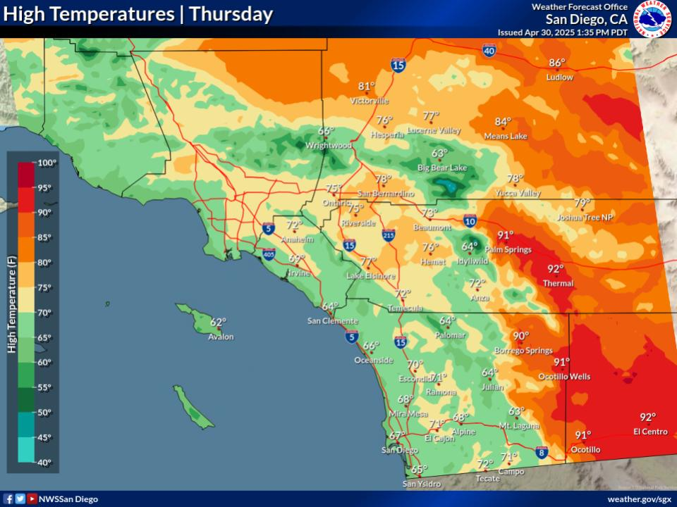
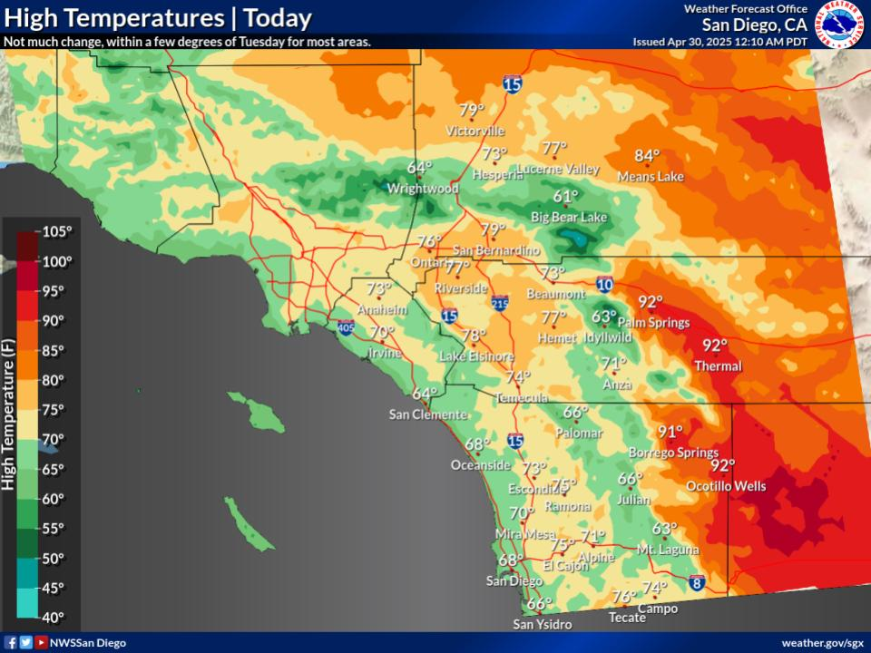
Dry weather will continue through the weekend. High temperatures
will warm slightly near the coast today to around 5 degrees for
the deserts to within a few degrees of average for most areas with
not much change on Thursday. High temperatures will range from the
mid to upper 60s near the coast to the mid 70s to lower 80s for
the Inland Empire with the lower deserts around 90.

There will be additional warming for Friday and Saturday with
Friday high temperatures warming as much as 5 to locally 10
degrees for the valleys and lower elevations of the mountains.
With the warming, high temperatures will range from around 70 near
the coast to the lower to mid 80s for the Inland Empire with the
lower deserts in the mid 90s.

&&

.LONG TERM (Saturday through Tuesday)...
High temperatures on Saturday will warm a few more degrees, to 5
to 10 degrees above average for inland areas, with high
temperatures ranging from around 70 near the coast to the 80s for
the Inland Empire with the mid to upper 90s for the lower deserts.

A closed low pressure system centered off the California coast on
Sunday will move slowly inland into California on Monday and
Tuesday. This will bring a cooling trend for Sunday through
Tuesday with Tuesday high temperatures 5 to 10 degrees below
average for inland areas to as much as 10 to 15 degrees below
average for the mountains. High temperatures on Tuesday will be
mostly in the mid 60s to lower 70s for the coast and valleys with
the lower deserts in the upper 70s to mid 80s. There is also a
slight chance of showers some time around Tuesday.

&&

.AVIATION...
300930Z....Isolated and brief low clouds around 1500 feet MSL at the
coast through 16Z. Low clouds more likely after 05Z tonight into
Thursday, with bases around 2000-2500 feet MSL and reaching into
valleys.

Otherwise, mostly clear today, but with increasing clouds tonight
above 8000 feet MSL.

&&

.MARINE...
No hazardous marine conditions are expected today through Sunday.

&&

.SKYWARN...
Skywarn activation is not requested. However weather spotters are
encouraged to report significant weather conditions.

&&

.SGX WATCHES/WARNINGS/ADVISORIES...
CA...None.
PZ...None.

&&

$$

PUBLIC...17
AVIATION/MARINE...MM


