938
FXUS65 KVEF 290727
AFDVEF

Area Forecast Discussion
National Weather Service Las Vegas NV
1227 AM PDT Wed Apr 29 2026

.KEY MESSAGES...

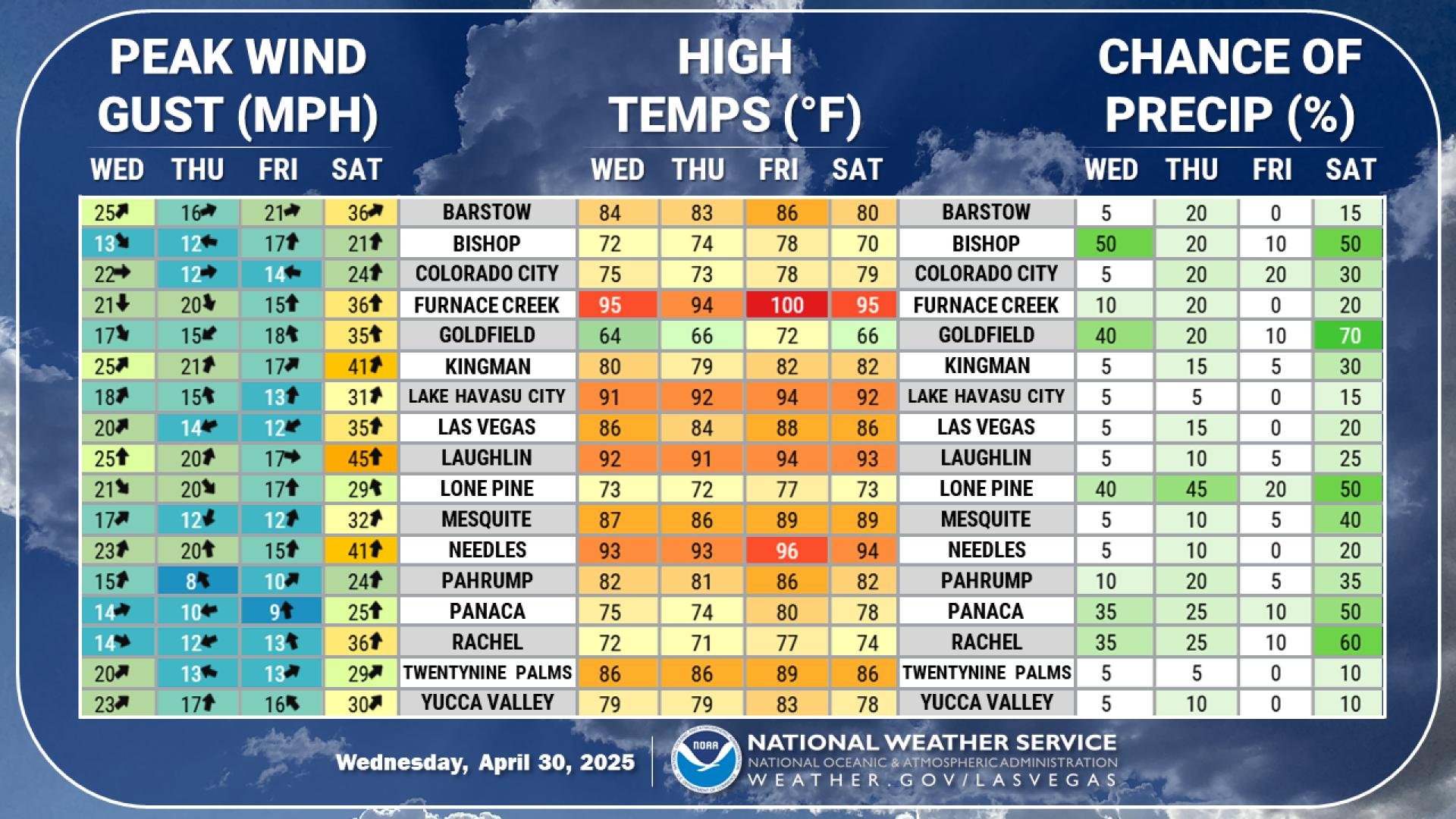
* Warming trend will continue through the weekend.

* Cooler conditions will return next week with increased chances
  for shower activity across the Sierra and Great Basin.

&&

.DISCUSSION...through early next week.

Shortwave which sparked a few showers across the southern Great
Basin today is moving east early this morning en route towards the
Four Corners. Broad troughing remains across the West through it`s
fairly weak and slight height rises today will allow for gradual
warming trend to continue. On Thursday, a weak shortwave will
drift across the Baja but generally remain south of the US Border
and have fairly limited impact on our region besides some high
clouds. Then one weaker shortwave will drop into Northern Arizona
from Utah and mostly just stir up the north winds down the
Colorado River all the while a slow warming trend continues. By
the weekend, stronger ridging will finally build into the Four
Corners region allowing for temperatures to peak several degrees
above normal Saturday and Sunday.

By early next week, a deeper trough will drop south along the
California coast and slowly move inland. There remains uncertainty
on its depth and exact track, but a cooling trend and a return of
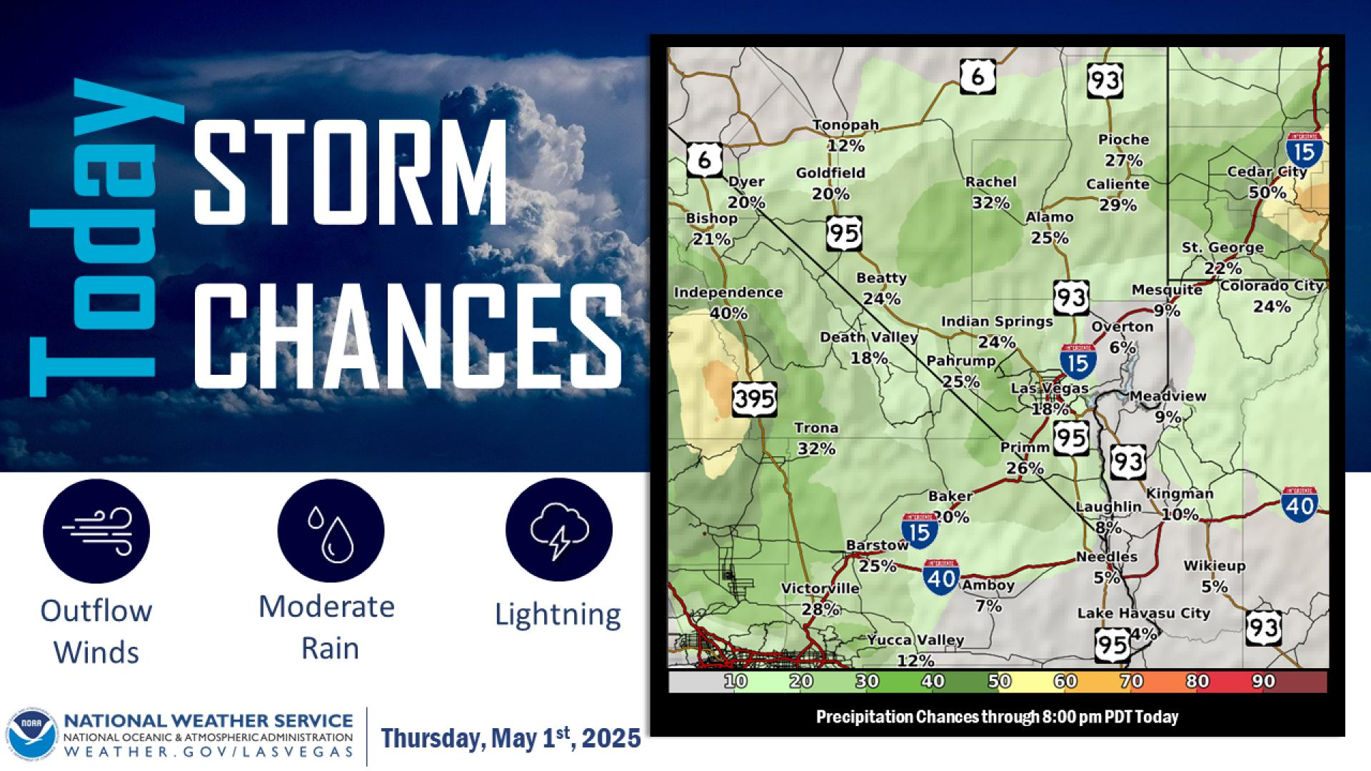
shower chances, especially across the Sierra and southern Great
Basin is expected.

&&

.AVIATION...For Harry Reid...For the 06Z Forecast Package...Winds
through the forecast period will remain light, around 6KT, and
follow typical daily directional patterns with some variability,
particularly in the morning and early evening. VFR conditions will
prevail, with passing bands of mid- level and high clouds with
bases at or above 10kft.

For the rest of southern Nevada, northwest Arizona and southeast
California...For the 06Z Forecast Package...Lingering showers
across the southern Great Basin will dissipate early in the
forecast period, with dry conditions thereafter. Winds across the
region will follow typical daily directional patterns the next 24
hours, with speeds around 5-10KT. The exception to this will be
across the western Mojave Desert/KDAG, where winds maintain a
westerly component through the period, with sustained speeds
around 10-12KT and intermittent gusts to around 20KT tonight and
again late Wednesday evening. VFR conditions with passing bands of
clouds at or above 10kft will continue.

&&

.SPOTTER INFORMATION STATEMENT...Spotters are encouraged to report
any significant weather or impacts according to standard operating
procedures.

&&

$$

DISCUSSION...Outler
AVIATION...Phillipson

For more forecast information...see us on our webpage:
https://weather.gov/lasvegas or follow us on Facebook and Twitter
NWS Las Vegas (VEF) Office

